Jp
Menu
English
Arabic
Brazil
French
German
Italian
Russian
Simplified China
Traditional China
Spanish
Turkey
India
Vietnam
Japanese
Korean
アプリについて
お問い合わせ
Jp
English
Arabic
Brazil
French
German
Italian
Russian
Simplified China
Traditional China
Spanish
Turkey
India
Vietnam
Japanese
Korean
This section is not available yet
ホーム
地図
大韓民国
청풍면
区
トップの場所
エンタメ
アトラクション
アトラクション
観光スポット
ビジネス
宿泊
ホテル
店
ヘルス
食事
レストラン
教育
幼稚園
交通機関
駅
お金
郵便局
アトラクション
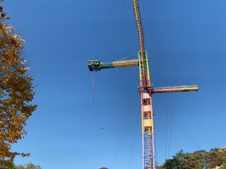
청풍랜드
3.2
청풍면 교리 산26, 堤川市, Chungcheongbuk-do, 大韓民国, GPS: 37.012962,128.17717
クレジットカード
+
more
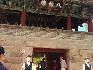
청풍문화재단지
청풍면 청풍호로 2048, 물태리, 堤川市, Chungcheongbuk-do, 27214, 大韓民国, GPS: 37.004745,128.17122
ホテル
청풍리조트 (Cheongpung Resort Hotel)
1.5
レストラン
문화재횟집 (Munhwajae Fish Restaurant)
2.0
청풍루횟집
1.5
幼稚園
Cheongpung Elementary School Kindergarten
1.5
Iyang Elementary School Kindergarten
2.5
観光スポット
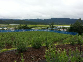
Cheongpungdaegyo Bridge
2.5
郵便局
청풍우체국 (Cheongpung Post Office)
1.0
駅
イヤン駅 (이양역)
이양면 이양로 134 (경전선), 오류리, 화순군, Jeollanam-do, 58165, 大韓民国, GPS: 34.890755,126.98931
Show on map
Show list
MAPS.ME
いつも手元に
アプリをダウンロードして、自分の視野を広げよう
MAPS.MEのアプリを開く
ウェブバージョンを使う